
The UK’s leading drone experts join forces with GeoCue to offer the complete TrueView LiDAR product range, from entry-level to engineering-grade solutions.
Huntsville, AL. – GeoCue is pleased to announce a new distribution partnership with Coptrz, the UK’s leading commercial drone experts. Through this collaboration, Coptrz will now provide customers across the United Kingdom with the complete line of TrueView 3D Imaging Sensors and LP360 LiDAR Processing Software, expanding access to cutting-edge aerial mapping technology for surveyors and engineers.
Founded in 2016, Coptrz has been a pioneer in the UK drone industry, offering impartial end-to-end solutions that include hardware, software, pilot training, and sector-specific expertise. Their commitment to delivering world-class drone programs to more than 2,000 businesses makes them an ideal partner for GeoCue.
According to Simon Harris, Managing Director at Coptrz, adding GeoCue’s solutions enhances their ability to meet the needs of a rapidly growing market: “We have added the TrueView product line-up to our portfolio of drone solutions to ensure our customers have access to the most complete and technologically advanced range of LiDAR products on the market. What impresses me most about GeoCue is their full range of options, from entry-level systems like the TV 1 Lite to engineering-grade sensors like the TrueView 720. This allows us to ensure our customers always have the right tools for the job.”
The partnership is also being celebrated within GeoCue. “We’re thrilled to have Coptrz join our global distribution network,” said Samuel Flick, European Sales Manager at GeoCue. “Coptrz is the leading drone solutions provider in the UK, with unmatched expertise in helping organizations adopt drone technology at scale. That makes them a perfect match for our TrueView LiDAR portfolio. Together, we can deliver a complete, best-in-class solution that ensures UK surveyors and engineers have the tools they need to succeed.”
Looking ahead, GeoCue anticipates strong growth in the UK market with Coptrz as part of its network. “By adding Coptrz to our distributor network, we’re not just growing our footprint in the UK, we’re aligning with the country’s most trusted drone solutions provider,” said Vincent Legrand, Vice President of Global Sales at GeoCue. “Their reach and reputation in the market will accelerate adoption of our TrueView LiDAR technology and ensure surveyors and engineers across the UK can access the very best tools for high-accuracy mapping.”
About Coptrz
Founded in 2016, Coptrz is the UK’s premier commercial drone expert, offering impartial advice and end-to-end drone solutions. With over 30 global industry partners and more than 12,000 pilots certified, Coptrz has empowered over 2,000 businesses to integrate drone technology into their operations. From surveying and construction to public safety and energy, Coptrz transforms operational efficiency with better, faster, and safer workflows.
To learn more about Coptrz visit www.coptrz.com
About GeoCue
GeoCue brings geospatial experts the very best in drone, mobile and land surveying equipment, geospatial point cloud software, workflow, training, and support for high-accuracy LiDAR and Imagery 3D mapping to help civil engineering and surveying professionals achieve successful data collection, processing, and management.
With TrueView LiDAR/Imaging sensors and LP360 point cloud data processing software, we are the leader in LiDAR mapping processing in North America able to meet customers where they are in terms of technology, adoption, budget, and resources.
To learn more about GeoCue, visit www.geocue.com.
Related
Discover more from sUAS News
Subscribe to get the latest posts sent to your email.
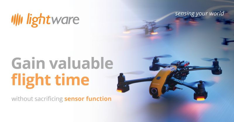
Regardless of your UAV application, payload matters, and counting grams is something all engineers and mission managers do.
It’s worth remembering how the word ‘payload’ came into being. The term combines ‘pay’ and ‘load’, originating in the early 20th century, as logistics companies started adding truck and flight options beyond ship and rail.
For many UAV applications, the payload’s value isn’t a delivery – it’s sensory. Gimbal sensor payload adds features and capabilities that operators need for security, search and rescue (SAR) or wildlife applications. A UAV’s gimbal payload value is measured in the sensor’s features and capability at a given weight.
Compact UAVs are superior for complex low-altitude missions in challenging natural terrain, like hilly areas, ravines and forests, or densely developed urban environments with high structural collision risk. They operate between buildings, securing perimeters navigating tree canopies, avoiding ledges or searching deep into ravines. These are missions where compact UAVs fly more confidently and have less collision risk and limitations than large UAVs.
Vehicle integration is another considerable advantage of using compact UAVs. First responder transport and logistics are much easier when a security, search and rescue (SAR) or wildlife UAV is compact enough to fit in a vehicle.
Amongst first responders is a saying: “the best equipment is what you have with you.” UAVs that can fit in a trunk, loadbed or passenger vehicle cargo area are also usually light enough to be easily handled and launched by one or two people, instead of requiring a team and additional rotor assembly technicians to get it set-up and configured for flight.
Sub 2kg (4.4lb) UAVs and payloads
For all the benefits of portability and flight agility that compact UAVs have, like all UAVs, they are proportionally sensitive to payload mass. Adding components increases their payload weight and erodes flight endurance, but how much does that really matter?
Canadian aerospace research and testing company, Tyto Robotics, has evaluated the influence of payload weight on flight time. The conclusions are notable for operators interested in the performance of compact UAVs under 2kg (4.4lb) in weight. Why? The testing benchmarked a 1.6kg (3.5lb) UAV, which is something in the weight category that agile security, law enforcement, wildlife, and SAR teams could use.
Using the Tyto Robotics’ model, a 1.6kg (3.5lb) UAV has an unladen flight endurance of just under 40 minutes, and the influence of payload is dramatic. Adding just 400g (14oz) of payload reduces the flight time to just over 30 minutes, meaning you sacrifice nearly 10 minutes of operational capability. Larger batteries aren’t the solution, as bigger ones add more weight, compounding the issue.
Engineers and mission managers must balance the needs when operating in demanding conditions with the challenge of sourcing and integrating the best components at the lowest possible weight. Efficiency and lightweighting are both guiding principles and challenges for UAV and gimbal OEMs, when selecting components and calculating weights.
Go lighter – fly longer
Accommodating all the sensors and optics to create true sensor fusion for a UAV in the security, conservation or search and rescue role, requires a diverse selection of components, each complementing each other – but also compounding weight.
If 400g (14oz) of payload reduces a 1.6kg (3.5lb) compact UAV’s flight time by nearly a quarter, it’s obvious how valuable lightweighting the sensor payload is – by even a few grams. Those few grams saved by choosing lighter components can become precious minutes and seconds of flight time, which makes the difference between discovering or missing a person’s location during a search and rescue mission.
LightWare’s LiDAR rangefinder sensors are globally proven and widely used for UAV applications, bringing all the benefits of ultralight design and enhanced flight time to UAV fleets across diverse applications. During demanding law enforcement, security, or search and rescue missions, LightWare’s ultralight LiDAR sensors enhance capability and help keep your UAVs airborne – for longer, by being lighter.
Even a few seconds of flight endurance and hover time can be the difference between identifying, locating or missing a search object or area of interest. Whether your UAV provides security overwatch or is the primary technology driving a time-critical search and rescue operation, you never want to overpromise and underdeliver on operational flight time.
Enter the ultralight laser rangefinder
The challenge for OEMs producing UAVs with gimbal sensor payloads is delivering comprehensive capabilities with the least influence on flight time. LightWare’s product solutions are true to the company name: ultralight sensors, that enables sensor fusion and optimize flight times.
Ultralight sensors from LightWare, like the GRF-250 LiDAR rangefinder, can create a payload that earns its keep by helping keep those UAVs in the air longer.
Developed by LightWare’s dedicated engineering team, the GRF-250 delivers 250m / 820ft laser rangefinding capability for your gimbal payload into your compact UAV fleet – at only 10.65g / 0.376oz.
Engineered for efficiency
Beyond delivering the depth detection and sensor capability users need from a laser rangefinder, the GRF-250 is designed for ease of integration and total power system efficiency.
Some components and technology applications can have a ravenous appetite for precious UAV battery power. Adding battery capacity creates an escalating weight-trap for UAV engineers. It’s not the solution. Choosing sensors designed, tested and proven to be terrifically power efficient is.
GRF-250 is engineered to have amazingly low power demands at only 120 mA, delivering excellent mid-range laser rangefinder performance in demanding conditions without robbing your UAV of valuable onboard power. The result is uncompromised functionality and optimized flight endurance.
When first responders activate in an emergency or provide primary overwatch for an escalating situation, every second of UAV flight endurance matters. By selecting gimbal payload sensors optimized for integration and designed with true lightweight engineering principles, mission managers can gain those valuable flight time seconds that make all the difference in real-world conditions.
Compact UAV flight times are dramatically influenced by weight – and the margins are small. You don’t need to sacrifice capability to save critical weight on your gimbal sensor payload. With GRF-250, LightWare’s created the gimbal integrated mid-range laser rangefinder commercial UAV operators need, saving valuable specification mass that matters when your UAV gets airborne.
Related
Discover more from sUAS News
Subscribe to get the latest posts sent to your email.
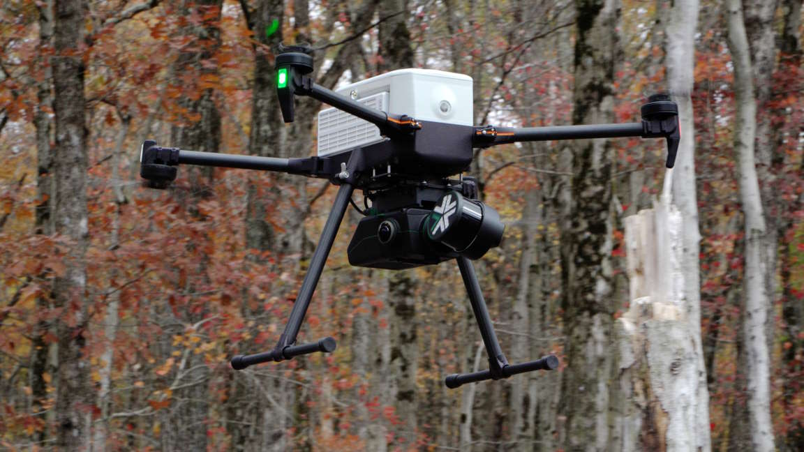
Exyn Technologies, a pioneer in autonomous robotics, today announced its modular 3D mapping solution, Nexys, is now compatible with the IF800 Tomcat system from Inspired Flight Technologies (IFT), a U.S.-based manufacturer of unmanned aerial vehicles.
“The combination of the Nexys autonomous mapping system and the Inspired Flight platform offers users a seamlessly integrated, U.S.-made, NDAA-compliant, and Blue UAS-approved solution to quickly capture accurate, colorized, real-time 3D point clouds, while maximizing operational efficiency and security,” said Brandon Torres Declet, CEO of Exyn Technologies. “We are excited about our partnership with Inspired Flight, and look forward to extending the Nexys ecosystem across a number of different robotics platforms.”
The IF800 Tomcat by Inspired Flight features a lightweight, compact, and foldable frame, making it easily transportable and deployable in diverse environments. With an impressive flight time of over 30 minutes when using the Nexys system, the medium-lift IF800 Tomcat maximizes operational efficiency and productivity. The IF800 is a no-compromise, compelling domestic solution for commercial and government agencies, ensuring the safeguarding of sensitive data and enhancing operational efficiency.
“We are thrilled to introduce the integration of the Exyn Nexys scanning solution on the IF800 Tomcat platform. This integration enables users to capture survey-grade data beyond visual-line-of-sight with extended flight times and 3D data visualizations in the field,” said Adam Bilmes, Director of Business Development at Inspired Flight. “This collaboration brings together two industry leaders, known for their exceptional performance, support, and service, ensuring customers receive the highest quality experience.”
Incredibly adaptable to changing environments, Nexys’s SLAM-based spatial mapping is capable of capturing up to 1.9 million scan points per second, while continuously updating the map as new data is received. Integrated on a drone like the IF800 Tomcat, users can manually pilot or use Exyn’s industry-leading Level 4B autonomy to capture otherwise impossible-to-reach data without the use of prior maps, GPS, or existing infrastructure. Our autonomy also supports beyond visual line of sight (BVLOS) and out-of-range communication flights, allowing the data to be collected onboard and streamed back to the user once back in range of communications.
About Exyn Technologies
Exyn Technologies is at the forefront of autonomous aerial robot systems development. Renowned for its commitment to innovation, Exyn focuses on crafting solutions that elevate safety and efficiency in challenging operational environments. Its commitment to delivering superior products and services continually shapes the future of autonomous exploration.
About Inspired Flight
Inspired Flight Technologies is an American drone manufacturer founded in 2017, in San Luis Obispo, CA. Inspired Flight is committed to applying values of quality, safety, and re-shoring American manufacturing. Inspired Flight aircraft are used in a wide variety of applications ranging from surveying and mapping, emergency response and public safety to industrial inspection.
Related
Discover more from sUAS News
Subscribe to get the latest posts sent to your email.