
The continent of Australia presents a unique logistical challenge, particularly across its vast, remote and strategically vital northern regions. For the Australian Defence Force (ADF), maintaining a continuous operational presence across such an expansive and unforgiving landscape demands highly innovative approaches to supply and support. Traditional methods of moving cargo are often stretched to their limits by the sheer scale of the geography.
Enter Project Jericho, the Royal Australian Air Force’s disruptive experimentation programme, which is pioneering the use of autonomous aerial logistics to build what military strategists term fighting depth. Central to this ambitious vision is the JabX, an uncrewed aerial system (UAS) based on the proven Jabiru 400 airframe, designed to transport heavy cargo over long distances. By automating routine cargo movements, the ADF aims to revolutionise its logistics tail, ensuring that dispersed teams remain supported without over-tasking the crewed transport fleet.
To understand the true significance of the JabX and the broader Jericho initiatives, one must consider the geographic and strategic realities of Australia. The north of the country is characterised by immense distances, sparse populations and challenging environmental conditions. Operating in this environment requires a robust and agile logistics network capable of connecting remote airbases, coastal areas and dispersed teams conducting littoral operations.
Traditional crewed aircraft are highly capable, but using them for routine supply runs across such vast distances is an inefficient use of valuable resources and personnel. The air force’s Jericho Disruptive Innovation (JDI) team is directly addressing these challenges. By focusing on autonomous aerial logistics, JDI is attempting to build fighting depth for the air force.
This concept involves creating layers of capability and resilience, ensuring that frontline forces have the continuous, uninterrupted support they need to sustain operations. When routine logistics are handled by autonomous systems, human aviators and crewed platforms are freed up to concentrate on complex decision-making, mission command and tasks that only people can perform, particularly in demanding or contested environments. As the deputy director of disruptive experimentation, Wing Commander Keirin Joyce, noted, these technologies are vital to ensuring the air force is ready for future challenges. He said: “By taking on routine logistics missions, autonomous aircraft will free up our aviators and crewed platforms for the tasks only people can do – particularly in demanding or contested conditions”.
The practical manifestation of this autonomous logistics vision is Project Camel Train, an initiative focused on prototyping and deploying UAS corridors across northern Australia. These dedicated flight corridors are intended to link remote airfields and coastal bases into a seamless, precision delivery network. The primary workhorse chosen for this ambitious undertaking is the JabX. Developed in collaboration with RFDesign, an avionics company based in Brisbane, the JabX is a heavily modified version of the popular Jabiru 400 airframe. The Jabiru 400 is already well regarded in light aviation circles, and adapting it for autonomous flight represents a pragmatic and highly efficient approach to capability development. The JabX is specifically designed for long-haul flights carrying heavy loads, featuring robust avionics, structured pre-flight and in-flight workflows, and an advanced graphical user interface that allows operators to maintain constant mission oversight.
The development process for the JabX highlights the immense benefits of using an existing, proven airframe rather than building a new design from the ground up. The director of Jabiru, Michael Halloran, explained that turning the J400 into an optionally crewed aircraft removes the vast time and resources typically required to develop a completely new platform. This approach drastically accelerates the development of autonomy systems because a safety pilot can be kept on board during the initial phases of test flying. Once the autonomous systems are fully developed, tested and proven, transitioning to a dedicated autonomous logistics platform is relatively straightforward. The final autonomous version will share 80% commonality with the crewed JU30 aircraft, meaning that production can be easily scaled up using existing commercial production lines and supply chains.
Integrating autonomous aircraft into shared airspace is not simply a technological challenge; it is a profound regulatory and safety hurdle. The Jericho team recognises that for autonomous logistics to become a reality, these robotic aircraft must navigate crowded or contested skies as safely as human pilots do. Every single component and system of the JabX is tested step by step as part of a strictly regulated pathway. This rigorous testing begins with human pilots operating in controlled settings. As the technology is proven and the regulatory framework permits, the aircraft gradually transition to higher levels of autonomy. The process is described as careful and transparent, keeping safety at the absolute centre of the programme while still enabling rapid innovation. This step-by-step methodology ensures that the ADF can build fundamental trust in the systems before deploying them for live operations across the vast northern corridors.
A critical enabler for long-range autonomous cargo operations is the ability of the uncrewed aerial vehicle (UAV) to safely separate itself from other aircraft sharing the airspace. To solve this complex problem, the Jericho team established Project Arena, a companion initiative to Project Camel Train
Related
Discover more from sUAS News
Subscribe to get the latest posts sent to your email.
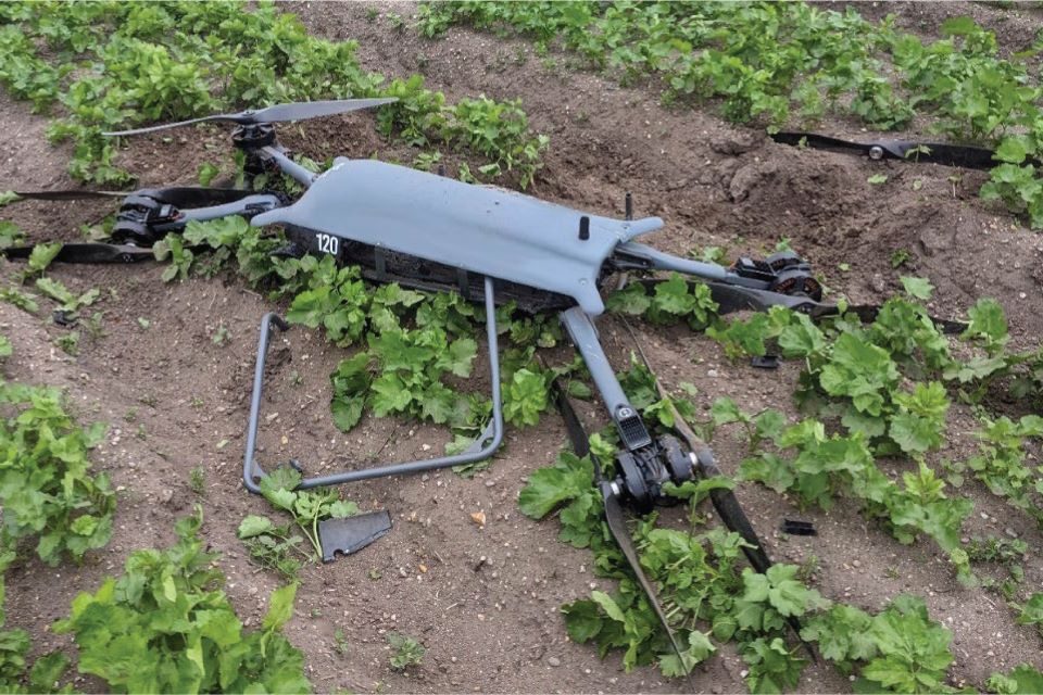
Whilst being operated in a manual flight mode, the unmanned aircraft breached the geofence and changed to an automated flight mode. In response, the remote pilot reduced the throttle and changed back to the manual mode. Control of the aircraft was lost because the mode was changed at a low throttle setting and the subsequent actions to regain control were unsuccessful. The aircraft struck the ground and was destroyed.
The operator no longer uses the manual mode and has promoted the use of standardised phraseology between the ground control station operator and the remote pilot. Further action has been taken to consider and apply a suitably sized geofence for each operational flight.
The Operation Safety Case on which the Civil Aviation Authority (CAA) granted a Specific Category Operational Authorisation were missing definitions and procedures for the use of geofences and actions to be taken in the event of a breach. A Safety Recommendation has been made to the CAA as these omissions have further effect as the use of a geofence is widely used as a mitigation for several other operational risks.
History of the flight
The Remote Pilot (RP) was undertaking a skills currency flight using a Malloy Aeronautics T150 unmanned aircraft and was assisted by a Ground Control Station (GCS) operator.
The RP and GCS operator were in two-way communication via radio. The RP was flying circuits in Stabilised flight mode (stab mode) at a training ground. It is a remote site on farmland used by the organisation he was contracted to fly with as an R&D and training pilot. The geofence for the flight was 40 m high by 300 m radius with the centre on the takeoff point. The dimensions of the geofence were not considered by the RP and GCS operator prior to the flight but accepted as a standard training envelope.
The GCS operator noticed the aircraft was approaching the upper limit of the flight geography zone within the geofence and he informed the RP using terminology not immediately understood by the RP. The RP was aware that the aircraft was turning to the right and climbing quicker than he had expected. Shortly afterwards the aircraft breached the upper limit of the geofence and reverted to an automated Return to Launch (RTL) flight mode.
The RTL automation initially commanded the aircraft to climb, which the RP instinctively counteracted by reducing the throttle. The GCS operator informed him that RTL mode was engaged, and the RP changed the flight mode, by cycling the three-way flight mode selector switch on the handheld transmitter, to loiter and then back to stab mode.
The aircraft diverged from level flight and was seen to follow an erratic flight path unfamiliar to the RP, during which it achieved a maximum pitch of -41° and -60.9° of roll. To regain control the RP increased the throttle to 100% which caused the aircraft to overcorrect, and it then pitched to 85.3° with 60° of roll before descending rapidly from a height of 37 m. The RP realised he could not regain control and switched to an automated mode (loiter mode) but by this time the aircraft was heading towards the RP’s ground position and he decided to close the throttle, bringing it to the ground.
Twelve seconds had passed from the geofence breach before the aircraft struck the ground approximately 50 m from the RP’s position and within the horizontal boundary of the geofence.
Discover more from sUAS News
Subscribe to get the latest posts sent to your email.